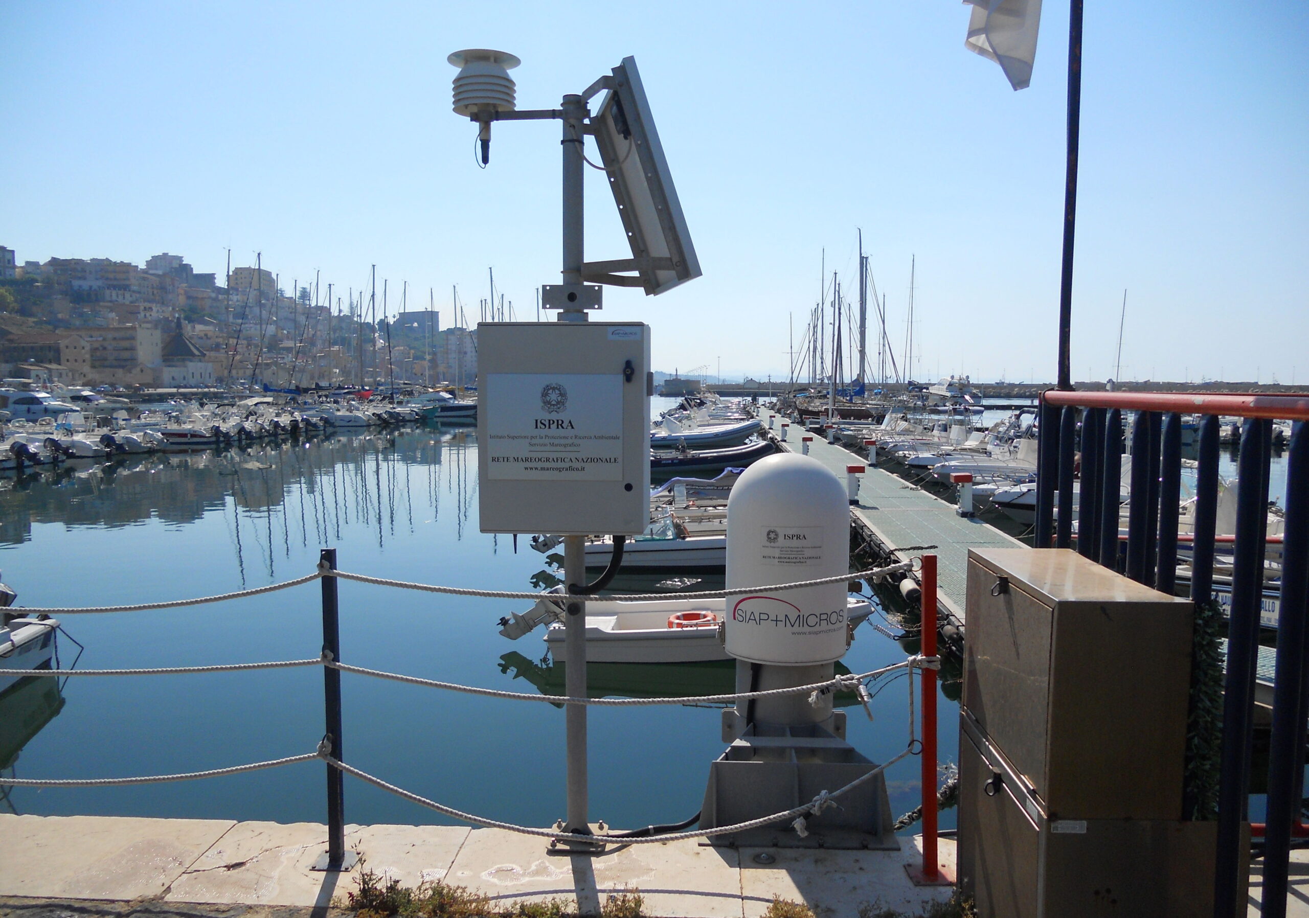
National Mareographic Network
Sea Level Measurement Network
Where
Installation sites of the Network
When
November 2020
Sector
Oceanography
The National Mareographic Network is the most important sea level measurement network in the Mediterranean. This is not surprising, given the 7,375 km of development of the Italian coasts and, above all, the particular morphology of our peninsula, which determines the division into the two main basins that can be considered semi-closed: the first is that of the western Mediterranean, delimited by the Sicily and characterized by large abyssal plains, the second, the eastern Mediterranean, is much more rugged and dominated by the Mediterranean ridge system.
SIAP+MICROS installed the new NMR which is configured on the backbone of the Historical Mareographic Network, a set of four sub-networks, conceptually distinguishable but technologically integrated:
1) Network for measuring sea level and determining tides and seises
2) Marine weather network of the Italian coasts
3) Network for the timely identification and characterization of anomalous waves (tsunami), their propagation and for the characterization of exceptional storm surges
4) Network for the qualitative characterization of the most environmentally sensitive marine areas
The sea level measurement frequency is for all stations at 1 minute (this acquisition frequency allows the measurement of anomalous waves and can be automatically increased to 1 second in the presence of extreme phenomena).
The RMN will soon be visible on a website www.mareografico.it which allows the visualization of data (both in real time and from the historical database), graphics and downloading and will facilitate consultation of the sections into which it will be divided: Mareograph , Rogue Waves and Water Quality.
Other applications

